


In case you missed it see what’s in this section
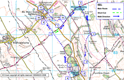
Ashbury Walk
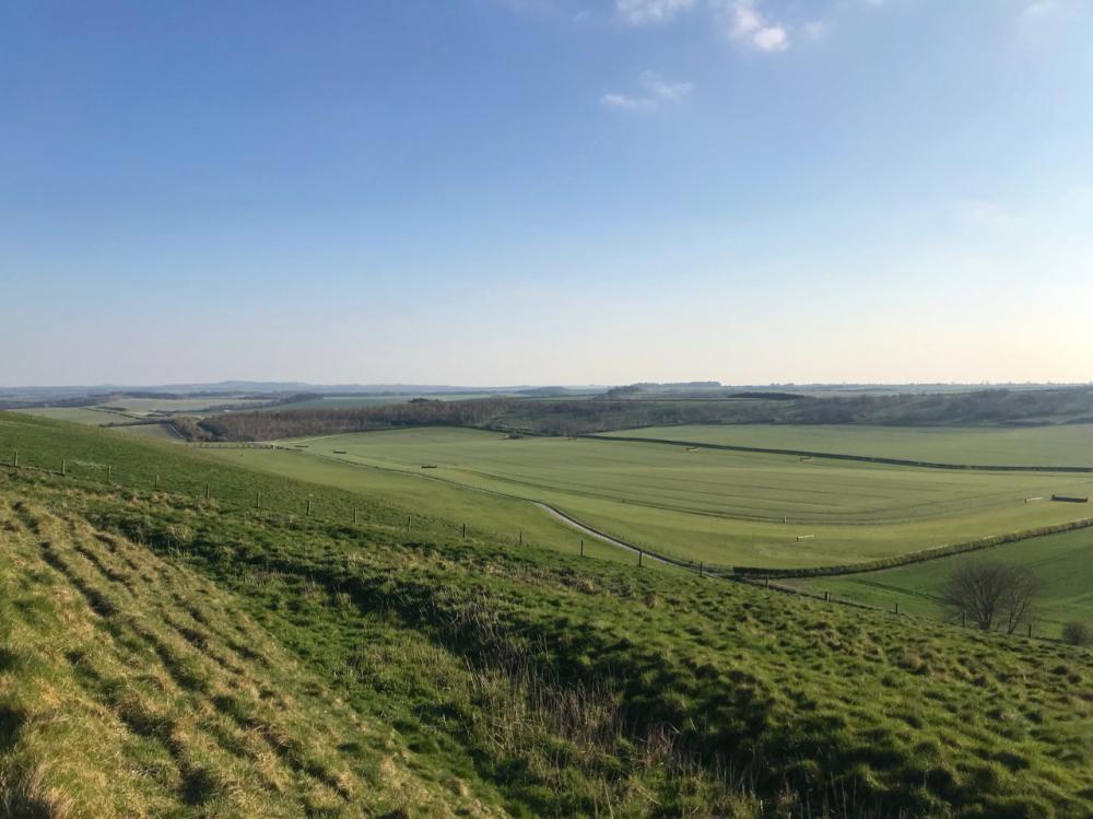
This walk is within the North Wessex Downs Area of Outstanding Natural Beauty 10 miles west of Wantage. They start on The Ridgeway and take you through classic chalk countryside with wonderful views of rolling downland and the Thames Valley. They include the attractive spring line village of Ashbury at the foot of the scarp and provide some fascinating historical and natural features to explore, also a cosy village pub perfect for taking a break to warm up in!
Walk: 7¾ miles (12½ km) with a shortcut 6 miles (9½ km) – allow 4 hours (3 hours for short route)
Terrain (main walk):
- Tracks, field paths through arable and pasture, and minor village lanes and footpaths.
- One relatively steep hill up and another down. 200m (660 feet) ascent and descent, one stile.
Terrain (short walk):
- Tracks, field paths through arable and pasture, and minor village lanes and footpaths.
- The walk is fairly strenuous with one relatively steep hill up. 95m (310 feet) ascent and descent. No stiles.
Where: The walk starts in the car parking area on The Ridgeway a mile southeast of Ashbury on the B4000 at map grid reference SU273843, To view it online click here.
Route map:
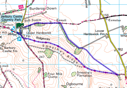
Barbury Castle Walk
Enjoy the views on this downland ramble where some of the finest scenery in southern England can be found, in particular the Marlborough Downs, which extend south from Swindon across the Vale of Pewsey to the northern flanks of Salisbury Plain. These expansive landscapes, with their wide skies and smooth ridges interspersed with long shallow combes, have captured the imagination of many writers, including Richard Jefferies. Why not stop off in one of the nearby pubs to warm up with a hot drink?
Walk: 5 miles (8km) - allow 3 hours.
Terrain:
- Ascent/gradient 262ft (80m).
- Tracks and byways, field paths, metalled lanes, 2 stiles.
Where: The walk stars in the parking area at Barbury Castle Country Park. Grid reference SU157761, view it online here.
Route map:
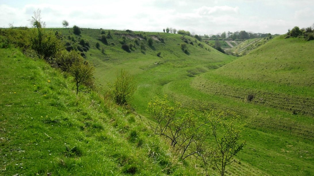
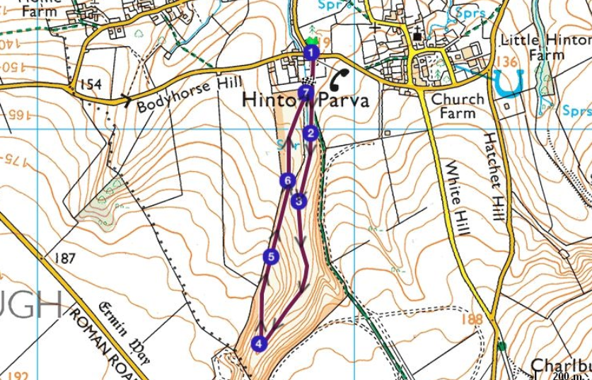
The Coombes Walk
Hidden in the small village of Hinton Parva, only a stone's throw from Swindon, is the stunning dry valley of The Coombes. It is an unspoilt stretch of countryside teeming with wildlife with steep slopes either side of you and lots of farmland birds all year round. With beautiful scenery it’s the ideal place for a swift winter walk, perfect for all the family.
Walk: 1 mile (1.6km) – allow 40 minutes.
Terrain:
- An all-rounder, easy walk.
- The bottom of the valley has a spring, so be sure to wear wellies!
Where: The walk starts at Hinton Parva car park. Grid reference: SU228832, view it online here.
Route map:
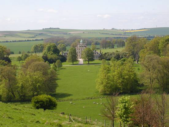
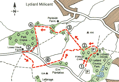
Lydiard Park Walk
A gentle rural ramble from a Palladian mansion and country park on Swindon's urban fringe, view the striking Grade I listed Palladian house and its surroundings in the stunning winter scenery. Seek a warming drink in the Forest Café within the park's visitor centre, or head further afield to the cosy Three Crowns at Brinkworth for excellent pub food.
Walk: 3.3 miles (5.3km) – allow 2 hours.
Terrain:
- Medium difficulty, ascent/gradient 65ft (20m).
- Field paths (can be muddy), tracks and metalled lanes, 11 stiles.
Where: Start off at Lydiard Country Park Parking area. Grid reference: - SU101844, view it online here.
Route map:
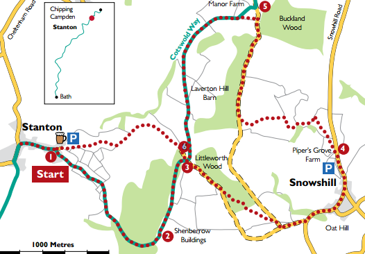
Stanton Walk
This beauty of a walk leads you between two of the most picturesque villages in the Cotswolds; over hilltops, down valleys and through sheltered woodlands. Whilst slightly more challenging, your efforts will be rewarded by invitingly warm pubs and some of the most splendid wintery views in the country.
Walk: 6 miles (9.65km) or 2½ miles (4km) – allow 4½ hours (2 hours for shorter route)
Terrain:
- Moderate difficulty, some steep sections.
- A few stiles.
Where: Start at the Cotswold Way signpost. Grid reference: SP071342, view it online here.
Route map: